
Follow our social profiles:


Contrast:


Page settings
Contrast:
Language:

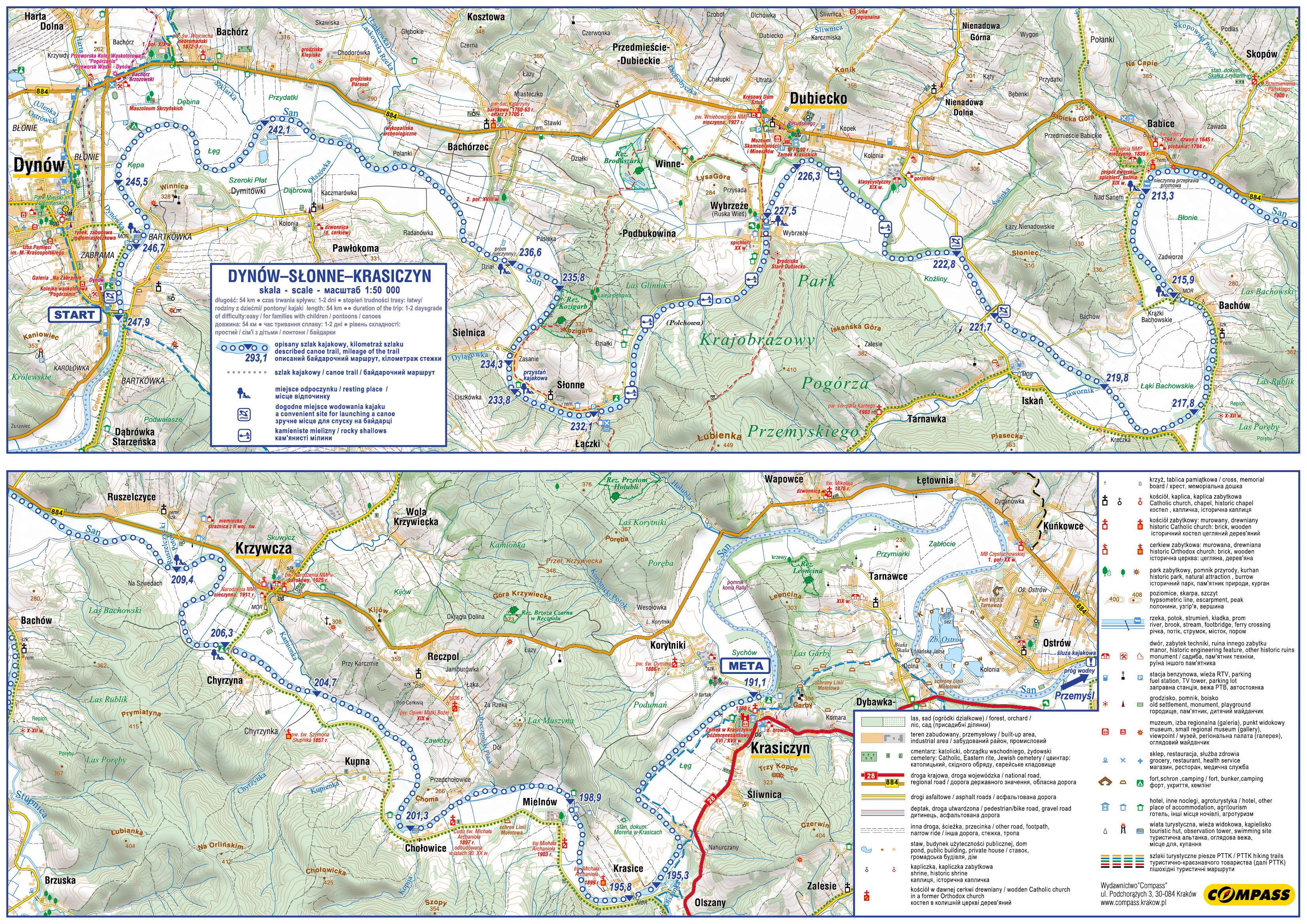
Rafting on the San river
Route: Dynów – Słonne - Krasiczyn
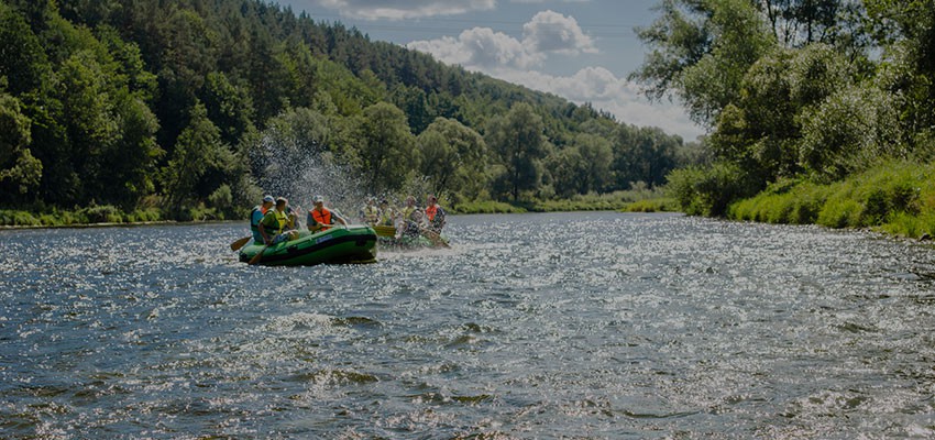
Length: 54 km
Duration of the trip: 1–2 days
Grade of difficulty: easy / for families with children / pontoons / canoes
Part 1 – section: Dynów–Słonne
Length: 16 km
Duration of the trip: 3 – 4 h
Start:
247.9 km – road bridge in Dynów – grass car park in Sanowa street, left side of the San River, 200 m from the bridge, easy access to the river and a place for launching canoes; another similar site 300 m below this place; roofed space with benches, camping possible;
247.4 km – Dynów-Bartkówka – a site with infrastructure for rest and camping, a Cyclists’ Service Area (MOR) on the Green Velo trail,
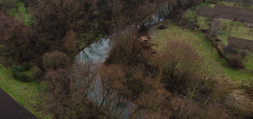
245.5 km – the mouth of the Dynówka stream, the San River turns to the east, runs across meadows and fields; low-gradient accessible banks with many pebble beaches;
242.1 km – the mouth of the Szklarka stream. Further on, the village of Bachórzec-Polanka; an island on the river;
236.6 km – Bachórzec-Pasieki – a closed ferry crossing on the way to Sielnica, on the right bank – roofed benches, a place to rest; Bachórzec - a historic church from 1763;
235.8 km – on the bend we enter the next gorge on the San River; here the river borders the Kozigarb nature reserve;
234.3km – Sielnica – the mouth of the Dylągówka stream;
233.8 km – left bank - canoe harbour, a campsite with shelters, toilet and shower;
232.1 km – Słonne – a hanging footbridge, a campsite, nearby farms offering accommodation - end of a one-day trip.
Part 2 – section: Słonne–Krasiczyn
Length: 36 km
Duration of the trip: 5-7 h
Start:
232.1 km – Słonne – campsite on the left bank of the San River, after a hanging footbridge; the river current here is clearly faster, the riverbed is about 2 m deeper, rocky shallows, single boulders emerge when the water level gets lower, the river runs taking gentle bends, the Pogórze Przemyskie Landscape Park on the right side;
227.5 km – Wybrzeże − a ferry crossing and a hanging footbridge, a holiday village with prepared campsites: on the right side past the ferry crossing there are roofed tables, a jetty for canoes, and a grocery store nearby;
226.3 km – the mouth of Drohobyczka river near Dubiecko – the landscape changes, the riversides are wild and inaccessible, numerous rocky shallows make canoeing difficult when the water level is low; in Dubiecko: the Castle of the Krasicki family (invisible from the river),
222.8 km – left bank - the mouth of the Świnka stream, long section without bends;
221.7 km – Iskań, a road bridge between Dubiecko and Bircza, a place for going ashore under the bridge;
219.8 km – the mouth of the Jawornik stream - the landscape changes, on the right side forests surround Bachów village;
217.8 km – the mouth of the Stopnica stream on the right bank; first buildings;
215.9 km – Bachów – a hanging footbridge, on the right side a Cyclists’ Service Area (MOR) on the Green Velo trail, access from the river along a steep slope, a convenient way to go ashore after the footbridge on the left bank;
213.3 km – Babice – a closed ferry crossing; you can go ashore on the right bank by the ferry crossing; behind the bend to the right there is an island in the river;
209.4 km – Ruszelczyce – a place to go ashore, a rocky beach at the site of a former boat crossing;
206.3 km – Krzywcza – by the right side of the road to Chyrzyna there is a very well-organized site for rest and camping, with roofed benches and a place for bonfires. The Green Velo bicycle trail runs here; the river bed is wide; it runs across fields and meadows;
204.7 km – left bank - the mouth of the Kamionka stream, a long straight section of the route; on the horizon - forested hills, a gorge section of the San River, the beginning of an attractive scenic part of the route;
201.3 km – Chołowice – the mouth of the Kopija stream, a rocky beach and a place for swimming; summer houses on the banks. Further there are two islands on the river, an Orthodox church of St. Michael the Archangel in the village;
198.9 km – a concrete road and the rocky beach on the grounds of a holiday resort hidden in the forest; buildings of the village of Mielnów on the other side;
195.8 km – Krasice – a suspension bridge; a Cyclists’ Service Area (MOR) on the Green Velo trail, roofed benches;
195.3 km – right bank - the mouth of the Olszanka stream;
191.1 km – Krasiczyn – a suspension bridge; on the right, after the bridge, a rocky beach, a convenient place to go ashore and a place to rest; the end of the canoeing trail.
You can continue your trip to Przemyśl, but it requires proper route planning. Less experienced canoeists should split the entire route into 3 days and plan their accommodation properly. The section of the San River from Krasiczyn to Przemyśl is 17 km long, and the river is wide with high and difficult to access banks covered with trees. There are very few places suitable to stop and rest. The trip ends in Ostrów near Przemyśl, before the weir.
 Download the trail cover
 Download the trail map


This online multimedia guide was created with the financial support of the European Union under the Poland-Belarus-Ukraine Cross-Border Cooperation Programme 2014-2020. The information contained herein is the sole responsibility of the Podkarpackie Regional Tourism Board. The content of this publication does not necessarily reflect the official position of the European Union MA or the Joint Technical Secretariat of the Poland-Belarus-Ukraine Cross-Border Cooperation Programme 2014-2020.